we offer GPS Machine Control Models, Surface Models, 3D GPS Models For your Earthwork Projects
At CD Construction & Design Solutions, we understand that you have many options when it comes to choosing a provider for your modeling needs. That's why we strive to offer you exceptional service, fair pricing, and a quick turnaround time.
We charge based on the amount of work that goes into each project. This pricing structure benefits our customers since some CAD files can be a disaster and require more work than others. By not pricing our services as a flat or minimum rate per project size or type, we can save you money. We'll give you a not-to-exceed price, and if we complete the project faster than anticipated, we charge accordingly. If it takes us longer than expected, that's on us. We've adopted this strategy based on our experience as contractors ourselves and dealing with exorbitant model prices on some sites. Our goal is to tailor GPS models to fit your needs, and your success is our success.
We can transform your information into a 3D model for your GPS. For a typical commercial site, we can have a model ready in 1-2 days, depending on the quality of information provided. In a time crunch, we'll try our best to provide you with it sooner. We can always give you the pad and rough grade to get you started while we finalize the rest. Road projects may take longer, but we'll provide an estimated time frame once we've had a chance to review the project.
We'll double-check the model to ensure that everything drains and there are no water holes. If there is an issue with the plan design, we'll let you know so you can either check with your engineer or instruct us to make the necessary adjustments.
We can provide as much or as little detail as you desire, including linework of the site, utilities, storm pipes, curbs, sidewalks, and more. We can even provide a model set to finish grade, which will save you money compared to having different subgrade models built.
If you have a private project that doesn't have an engineered plan, send us a topo of the area you want to work on, and let's discuss your goals for the end result. Whether it's a pond, parking lot, driveway, or something else, we can help you design and deliver a project that will make your customer happy.
Our experience gives us an unmatched familiarity with equipment setup, localization, installation, and operation from the office to the field. We can export to Trimble, Leica, and Topcon for use within your existing workflow. All exports can be requested as plan-sized pages in PDF, fully branded with your company name and include legends or other notes.
We hope you'll choose CD Construction & Design Solutions for your modeling needs. Contact us today to request more information or to get started on your next project.
Reach out to us for more info!

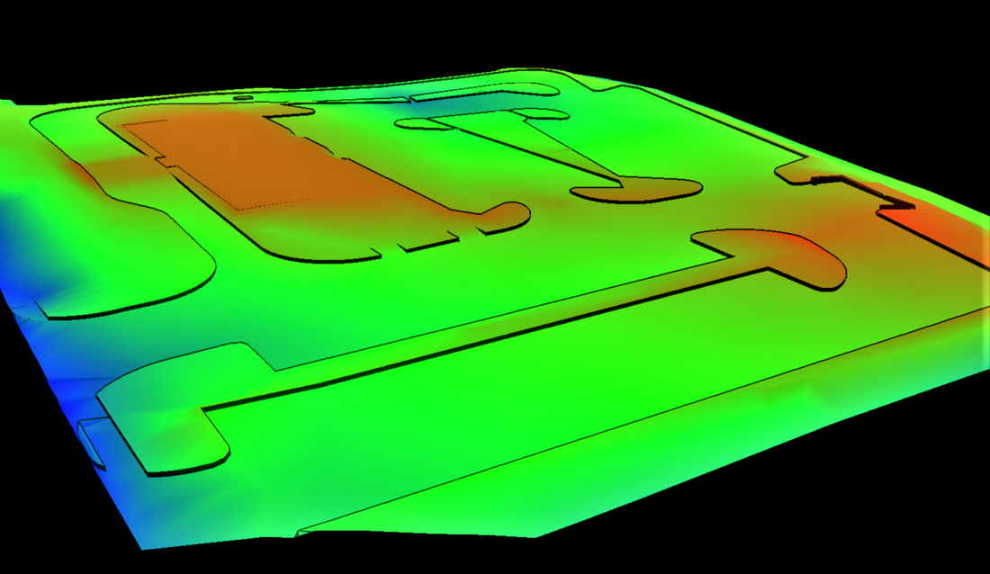
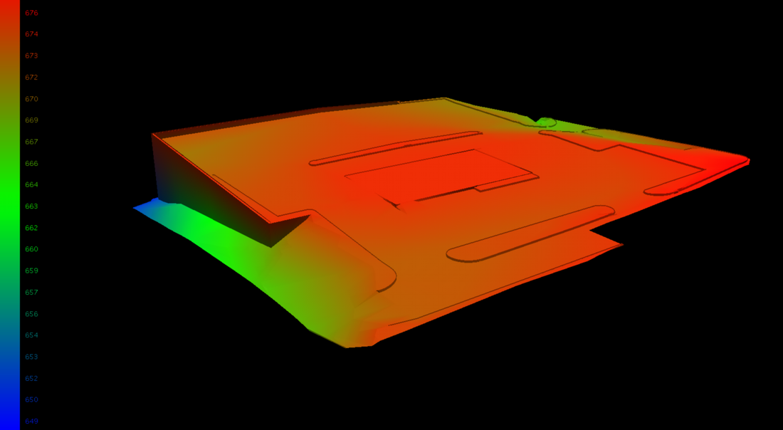
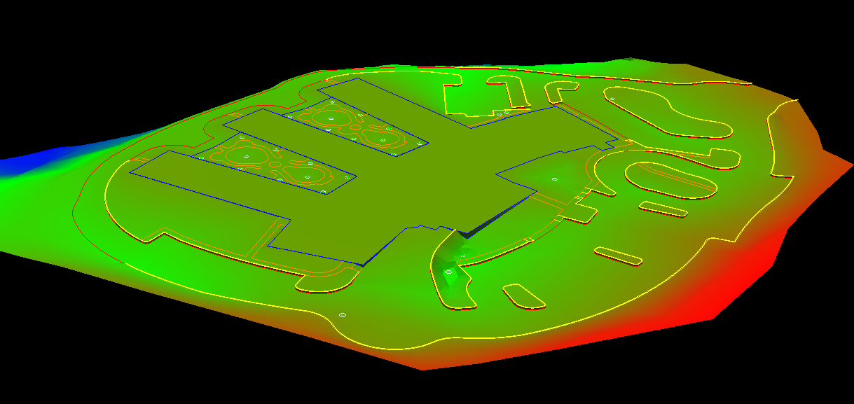
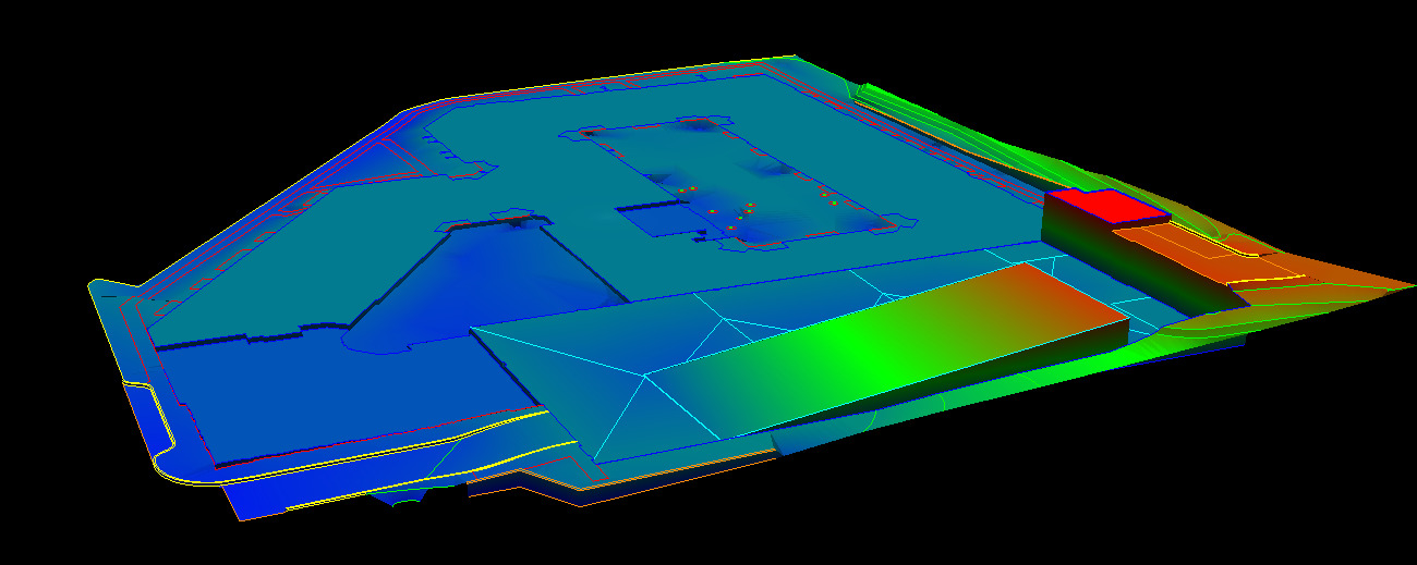
Picture 1: Surface or Machine Control Models require a lot of data crunching to
provide a beneficial result.
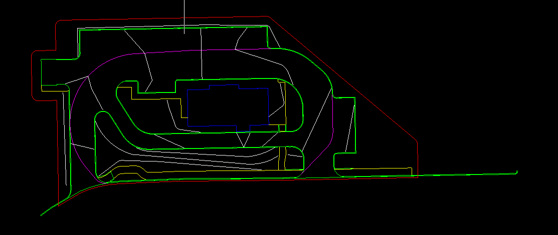
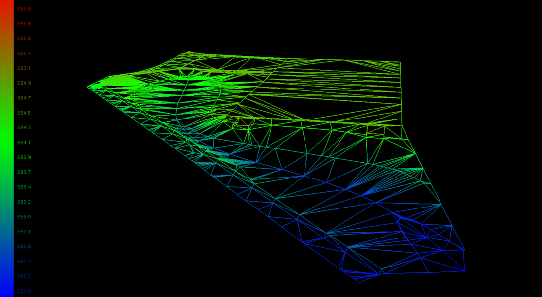
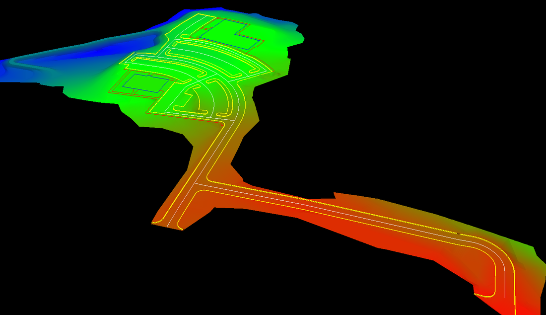
Picture 2: Basic line work assigned elevations and has been condensed down from
the CAD file
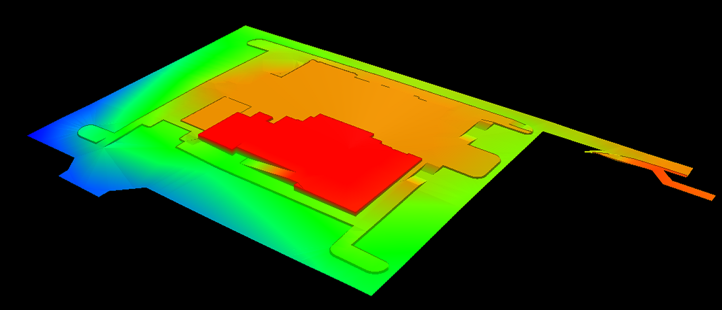
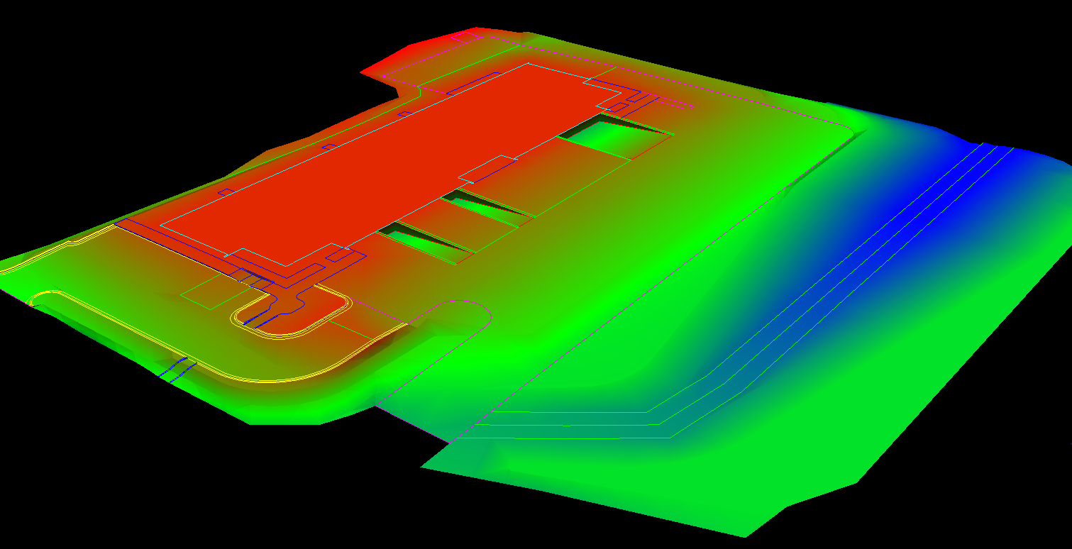
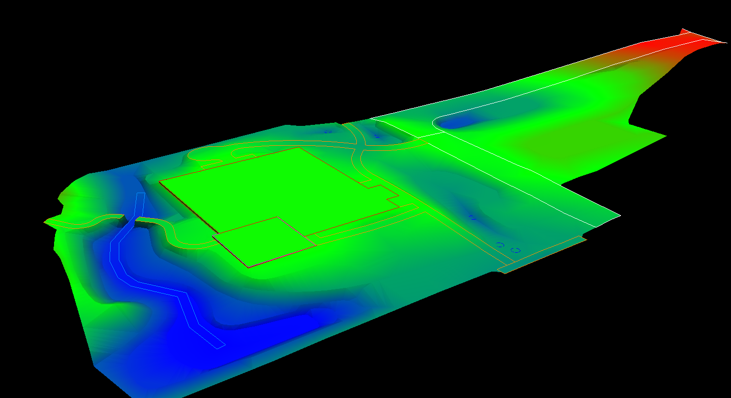
picture3: The finished product is an accurate 3D model of your Earthwork or
Commercial site
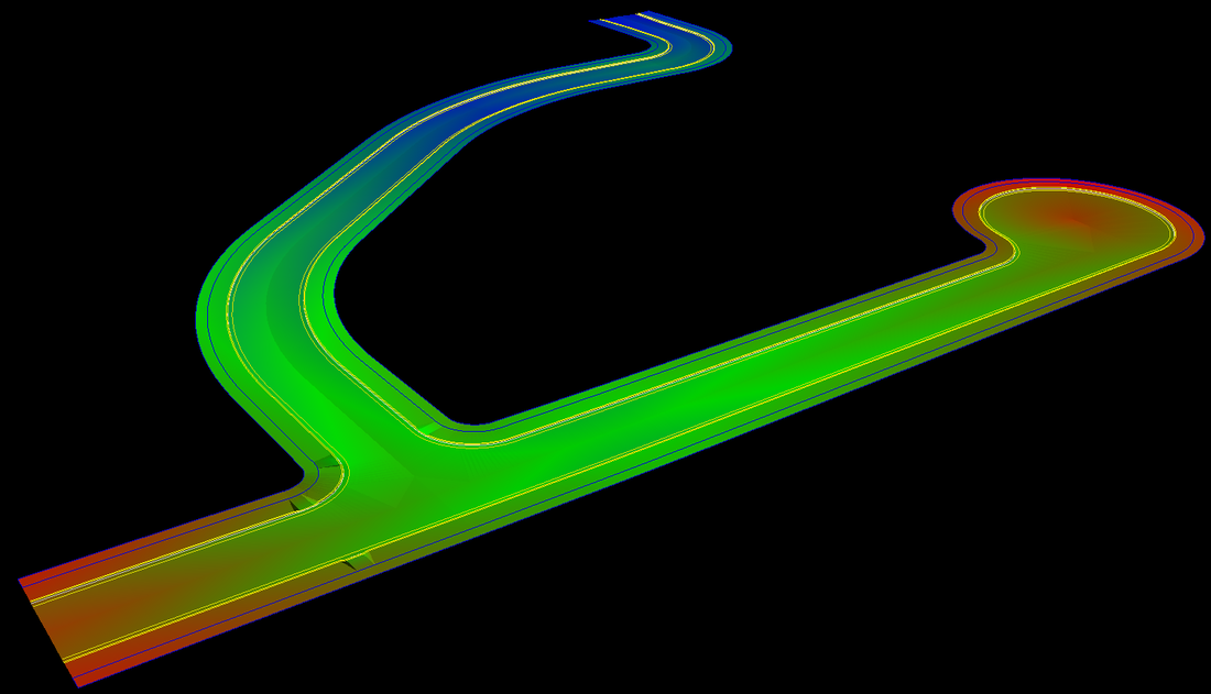
Earthwork contractors understand how critical drainage can be on a project. This video shows one way digital models can ensure water flows like it’s supposed to, which can highlight any issues before the work begins— saving cost and stress.
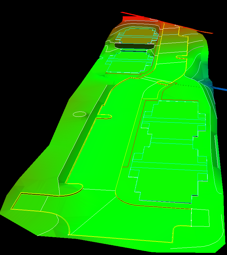
Here are some examples of models for our clients.